Large Maps and Pictures
I can be contacted at E-mail address:-
![]()
Large Maps and PicturesI can be contacted at E-mail address:-
|
|
|
Maps and pictures can exceed the size of the screen display, but still be used in a smaller frame. To demonstrate some features which come into play with 'over screen size' pictures, you will find a picture called 'base 1200 roads.jpg' in the root of the Base Network RM folder. This picture is a 1200x800 pixel road map which will be used in my Base net 800x600 pixel frame.
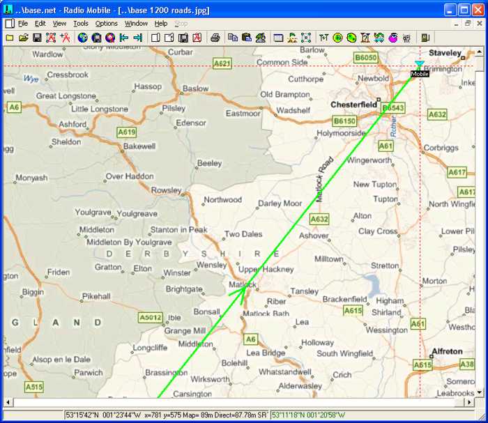
Opening the Base Net, I have moved the Mobile Unit to the North East corner of the map. This was achieved by clicking on the location to generate the cursor cross wires at that point, then with a 'right click' on the Mobile unit it was moved to the cursor position.
Next, a click on the
'Open Picture' icon
which shows the enlarged central area of the Base road map.
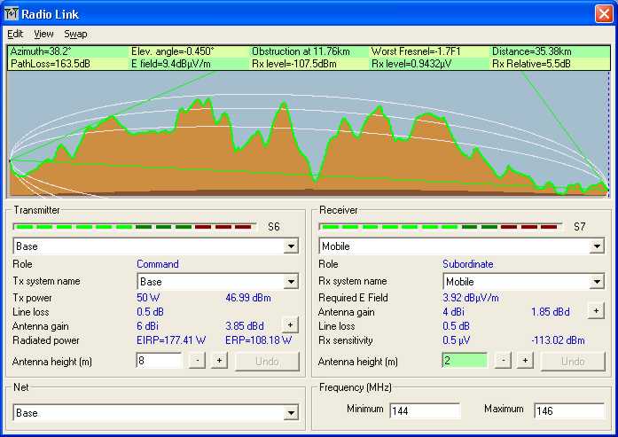
Next, click on the 'Radio Link' Icon
The main display will now have changed to show the cursor position at the Mobile unit end of the link
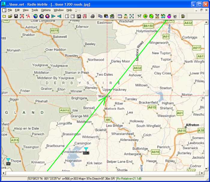
With the Radio Link pane active, pressing the 'Left Arrow' on the keyboard, moves the cursor in the Radio Link pane from the Mobile position towards the Base unit location. This movement is reflected by the cursor cross wire on the main screen moving along the radio path. As soon as the main screen cursor reaches the centre of the screen, the screen will pan to maintain a central view within the bounds of the large picture, as shown below.
In this mode the main screen picture can be changed for any other open picture using the 'Ctrl-1,2,3,4' buttons, (or Ctrl-Tab/ Ctrl-Shift-Tab when the focus is on the main screen), with the main cursor position being shown. This action changes program focus to the main screen, so to move the cursor again a click on the Radio Link top Blue bar is required. If more than one large picture is being used, the opening of a second using the Ctrl* key will place its view at the centre of the map. To centre this picture increment an arrow key, alternatively moving the profile cursor on the Radio Link pane will also centralise the displayed cursor position. Similarly, where a 'larger than screen size' network is generated, moving the cursor using the arrow keys, or by clicking on the elevation box heights, will centralise the cursor, and the map or picture will then roll under the cursor. The above actions also work with the 'Route Radio Coverage' feature. A suitable route file 'L1X-Ash-Bux.plt' is available in the Base Network folder if you wish to try this.
An additional feature added to the program allows the view area of the oversize picture to be moved on screen with the mouse by using 'Ctrl+mouse click and drag'.
Note: The maximum size of picture guaranteed for the program is 2000x2000 pixels, above this size the pixel number entered will change to red, but this limit can be exceeded. The absolute maximum size available is determined by your machine capability - the size of your graphic card memory and system RAM. It is worth while testing your own configuration by drawing a large map and then performing a 'merge' with say a road map from the internet. You will find that when you exceed your machine limit, the map will be drawn but the merge cannot be completed. As an example, my machine has a 128MB graphic card with 768MB of system RAM, operating under Win-XP. I am able to work with 6000x4500 pixel pictures and maps, but not 8000x6000 pixel. A large 6000 pixel map as above generates a ***.map file of 53MB, with the ***.jpg files associated ranging between 1.5MB and 8MB each, so they require a lot of memory. The 8000 pixel ***.map file was 94MB...
This page is available in .pdf format here
© Copyright G3TVU 26th October 2017
|
 enables 'base
1200 roads.jpg' to be selected and opened.
enables 'base
1200 roads.jpg' to be selected and opened.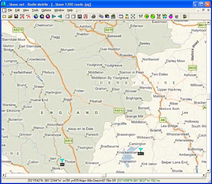
 which will display the Base to Mobile Link