Importing Pictures
I can be contacted at E-mail address:-
![]()
Importing PicturesI can be contacted at E-mail address:-
|
|
|
1 Importing Pictures into Radio Mobile. 2 Importing Radio Mobile pictures into Google Earth.
a)
Radio
Mobile generated images
1) Importing Pictures into Radio Mobile.
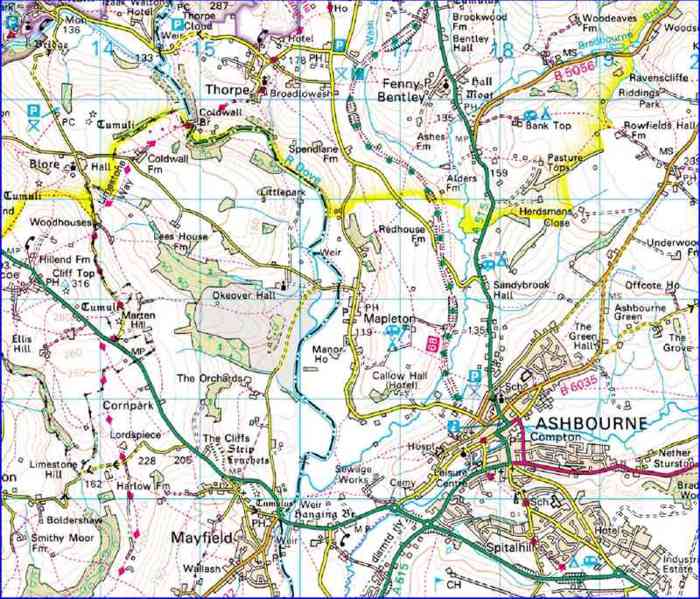
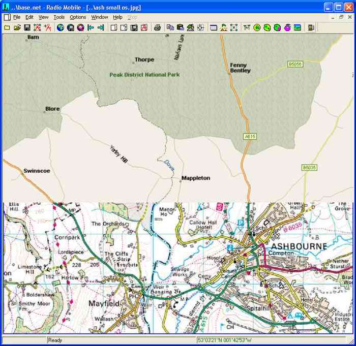
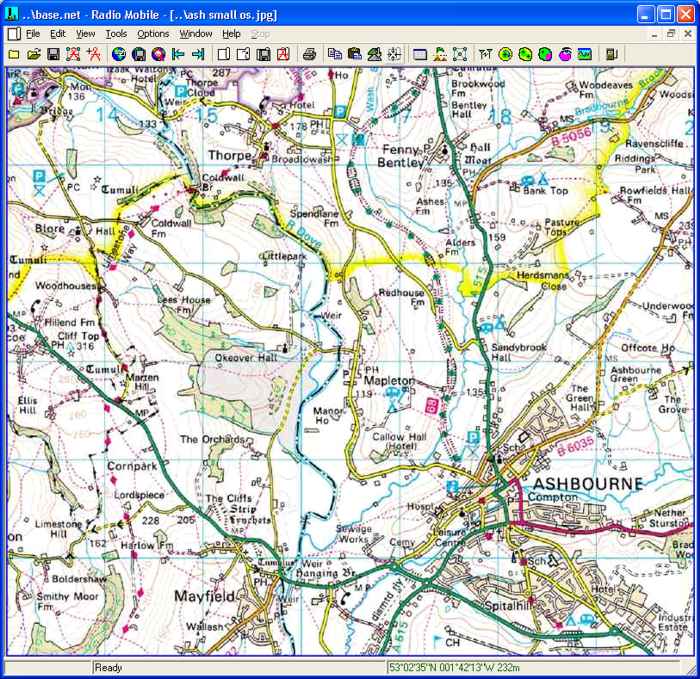
To demonstrate the importing of a picture into Radio Mobile, I have scanned the map below which shows an area of my Base network, and saved it in *.jpg format. This is just one of the formats supported by the program.
This picture shows the UK Ordnance Survey grid (OSGB-36) datum lines at a 1km grid, and has been carefully cropped to these to give precise corner reference points. In order to import the picture the corner datum points have to be converted to the WGS-84 datum.
For non-UK corner coordinate Datum conversions see Here.
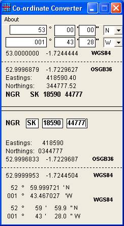
For UK users Jeff, G8HUL, has produced a stand-alone Latitude/Longitude Converter which is available from my Download page. The converter shown below, allows entries in WGS-84 format to be converted to OSGB-36 Latitude and Longitude and also to ten figure UK National Grid References. The lower part of the pane will accept up to ten digit UK National Grid References for their direct conversion to the WGS-84 datum.
Very small errors can be seen in the to/from conversions above, but remember that ten figure National Grid References are to 1 metre resolution!
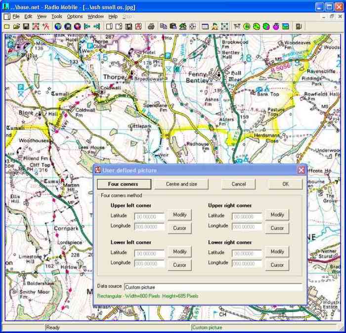
The map in .jpg format has been pasted into my Radio Mobile folder, and can be opened using 'File/Open Picture'. Alternatively, if the picture has been placed on the clipboard, use 'Edit/Paste as New Picture' to open it in Radio Mobile. If then 'File/picture properties' is opened the User Defined Picture calibration pane will open, and the 'Four Corners' button selected.
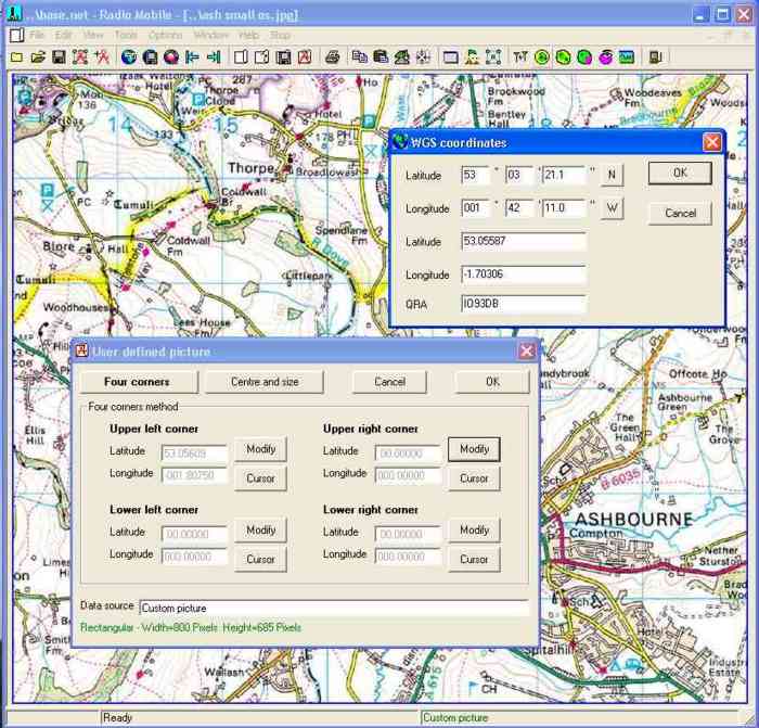
A click on a 'Modify' button then opens another pane where the selected corner coordinates can be inserted in WGS-84 format. The Upper Left entry has been saved and the Upper Right coordinate is about to be saved.
Note:- Make sure that if you use a West Longitude, that the value is either inserted with a -ve sign, or that the 'W' button is selected as above, otherwise your map will be at the wrong location! (The above -ve also applies for a Southern Latitude).
After finishing entry of all four corner coordinates and checking their values, a click on 'OK' will result in being asked if the calibration .dat file should be saved with the picture to complete the process.
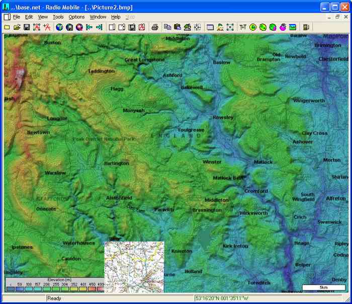
You will notice that the picture above had been re-sampled to a width of 800 pixels to fit in the frame of my Base Net. The actual size used just has an indicated limit of 2000 pixels displayed by the program. (It would appear however that a possible 6000 or more pixels can be used, but this is worth testing as it is machine dependant). A useful addition is to have a separately named version of the picture saved at maximum resolution which is much larger than the display map size. This oversize picture can then be used, if open in the program, as a source for merging with zoomed areas to give better resolution.
Alignment of these small maps can easily be checked by performing a 'Merge' over them with a road map downloaded from the internet, where the roads should be aligned - it is not necessary to keep this check road map. The map below has had the 'Merge' function stopped before completion to demonstrate the alignment achieved.
As a final demonstration, the small area OS map has been merged with the main Base Network map and 'Kept in New picture' to show its actual coverage area.
Non UK Coordinate Conversions:
A very 'convenient to use' program for this purpose is the Freeware version of Gartrip - available from http://www.gartrip.de/ , which has a multitude of local datum's available for conversions, especially if the full datum file from 'User Services-More Geodetic Datums' page is opened.
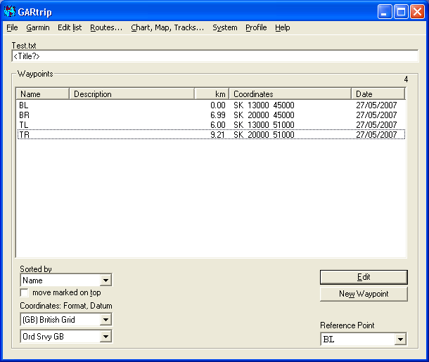
This is demonstrated below using the UK National grid where four New corner Waypoints have been added in Gartrip - Bottom Left/right, and Top left/right in the OSGB-36 format of the Ordinance Survey GB datum relating to my map.
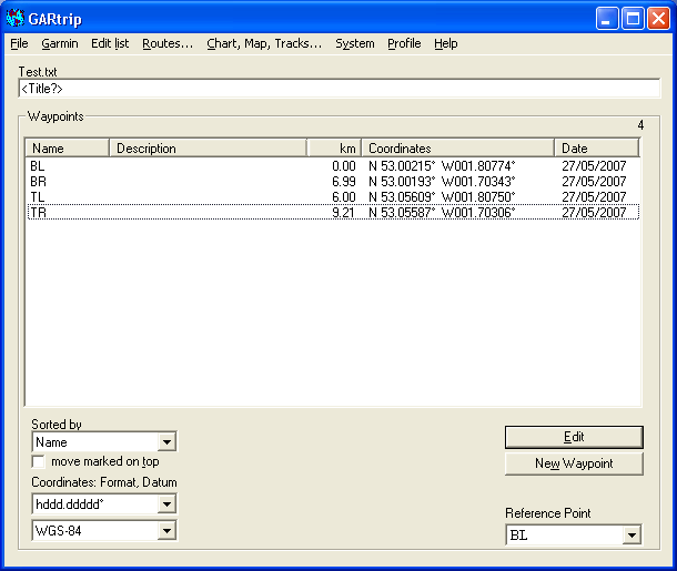
Selecting the WGS-84 format in decimal degrees produces the following converted coordinates for all four corners.
2 Importing Radio Mobile pictures into Google Earth
a) Radio Mobile generated images:
This technique may be used with any aligned picture from RM, a single colour coverage plot over a blank white screen gives very good results, especially if the image is processed to convert the white area into a transparent background format. This is directly possible from within Radio Mobile by saving the image in .gif* or .png formats. * Please note that .png format will work with all pictures, but large .gif images may be limited by computer characteristics.
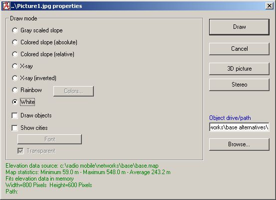
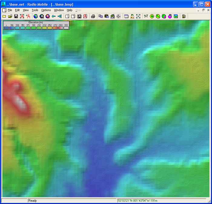
First, to produce a blank white screen which contains the elevation data, open a Map Picture and save it as the name 'Blank'. Next open 'Picture properties', and set them as shown below - select 'Grey scaled slope', contrast to 0% and Brightness to 100%. A click on 'Draw' will then produce a white screen which can be saved again as 'Blank'. This procedure is used to avoid overwriting the original source picture properties.
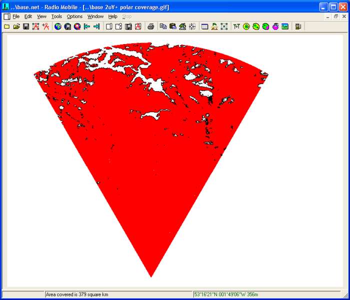
A plot can then be performed on this Blank picture, where the Polar Plot below, in solid red, shows areas where the Hand Held Unit receives a signal of >2μV from the Base Unit. This picture was then saved in .png or .gif* format as a new picture.
* Please note that .png format will work with all pictures, but large .gif images may be limited by computer characteristics.
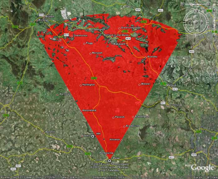
The image will also be saved as 'Picture name'.kml in the same folder. A click on this .kml file will then open Google Earth and display the plot as an overlay - the picture below has also had the network Base and Hand Held unit imported via .kml to show the results - opacity of the overlay can be adjusted as required using the slider in Google Earth control panel when the 'Picture name'.klm file is selected.
The Ordnance Survey map imported into Radio Mobile as (1) above , can also be imported into Google Earth. It is not possible to use the direct import above if the picture is saved in .gif format, as the picture doesn't align with the WGS-84 datum map. The picture may however be imported as an Overlay as shown in (i), or the preferred method is to align the picture with a WGS-84 map as shown in ii) for direct import.
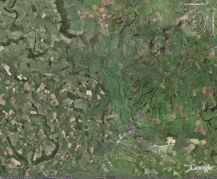
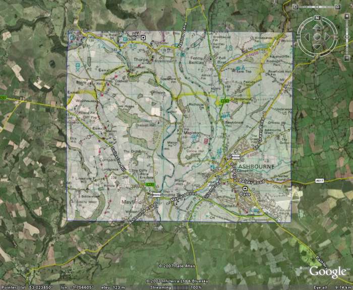
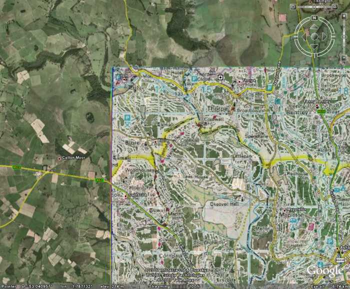
i) Picture import as an Overlay: The picture below
shows a portion of my Base Network which has been imported into Google Earth
(GE) via a .klm file as in
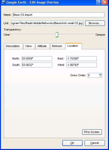
In Google Earth, opening 'Add/Image Overlay' produces the pane below, where the file 'Ash small OS.jpg' has been located from my Radio Mobile folder. Opening the 'Location' tab allowed the decimal degree boundaries from Gartrip above to be entered, and the opacity of the resulting picture to be adjusted. It is also possible to open the picture in RM, select 'Edit/Draw corner coordinates' and then read the boundary coordinates from it. Later Roger added the coordinates in decimal format as well as degree-minute-second format to facilitate this. Make sure you don't save the picture, use 'Keep volatile', unless you want a copy with the coordinates displayed!
It will be noticed that the above entries are slightly different to the Gartrip calculated values - this is because the OS grid is slightly skewed from the WGS-84 datum, so the picture had to be aligned within GE using the adjustment handles on the imported picture before saving. These are the final coordinates used, which show that the GE overlaid roads match the roads on the OS map imported.
ii) Picture alignment for Direct Import as .kml:
First, the calibrated User picture has to be opened in RM.
Then using 'Edit/Fit map to Picture', a new Map Properties pane will open, and the detail small area Map below can be extracted.
Next, this map is 'Merged/copy' with the User picture - and 'Kept in picture' to produce:
and the picture can then be saved in .png or .gif* format which will also save a corresponding .kml file for direct import into Google Earth.
* Please note that .png format will work with all pictures, but large .gif images may be limited by computer characteristics.
Examining the picture detail above, it can be seen that the roads and names from Google Earth line up with the Ordinance Survey map. The coloured borders on the left and top of the OS map, are where the Skew between the two datum formats caused the OS map to only partially cover the WGS-84 map with which it was merged.
Once a picture has been imported into GE, it is then possible to move and zoom the image as needed, and by selecting the imported file on the toolbar, adjust the transparency required.
As a picture is saved, Radio Mobile also generates a .klm file for it with the picture name in the RM directory. If Google Earth is installed on your computer, a double click on this file will open Google Earth and display the picture directly, placing the file in the Temporary Places folder of Google Earth. The transparency of the overlay can then be adjusted using the slider bar.
This page is available in .pdf format here
Please keep checking back for updates/additions.
© Copyright G3TVU 9th April 2019
|